Lines in the Sand: How America's Accidental Boundaries Became Sacred Geography

When Surveyors Became Gods
Charles Mason and Jeremiah Dixon spent four years dragging chains through Pennsylvania wilderness, marking trees and placing stone monuments to resolve a property dispute between the Penn and Calvert families. Their survey equipment was accurate to roughly fifty feet—impressive for 1767, but hardly precise enough to define the cultural identity of half a continent. Yet the line they scratched through forest and farmland became America's most psychologically powerful boundary, dividing "North" from "South" in ways that Mason and Dixon never intended and couldn't have imagined.
The transformation of surveying accidents into sacred geography represents one of humanity's most reliable psychological patterns. Arbitrary boundaries acquire the weight of natural law through repetition, institutional reinforcement, and the human need to believe that important divisions reflect deeper truths rather than historical contingency.
The Geometry of Political Compromise
Most Americans assume their state boundaries reflect logical geographic features—rivers, mountain ranges, or cultural divisions that made political separation inevitable. The actual history reveals boundaries determined by congressional horse-trading, surveying errors, and the practical limitations of eighteenth-century mapmaking.
Consider the northwestern border of Pennsylvania, where the state extends north of the 42nd parallel to secure access to Lake Erie. This rectangular appendage exists because Pennsylvania's delegation threatened to reject the Constitution unless the state gained a Great Lakes port. The compromise added fifteen miles of Lake Erie shoreline to Pennsylvania and subtracted the same territory from New York—a trade that seemed trivial in 1787 but determined the industrial development of entire regions.
 Photo: Lake Erie, via www.greatlakescruises.com
Erie, Pennsylvania, became a major shipping hub because of this arbitrary boundary adjustment. Without access to Lake Erie, northwestern Pennsylvania would have remained agricultural territory, its residents culturally and economically aligned with rural New York rather than industrial Pittsburgh. The psychological identity of hundreds of thousands of Americans was shaped by a rectangular compromise that could have been drawn differently without affecting any geographic or cultural logic.
The Surveyor's Revenge
The boundary between North Carolina and South Carolina illustrates how surveying limitations created lasting political divisions. The original colonial grants described the border as the 36th parallel, but eighteenth-century surveyors lacked the equipment to determine latitude accurately. Their survey wandered roughly twenty miles north of the intended line, placing what should have been North Carolina territory inside South Carolina.
This error meant that Charlotte, North Carolina—now the state's largest city—was originally supposed to be part of South Carolina. The economic and political development of the entire region would have proceeded differently if surveyors had possessed better instruments. Instead of two separate state economies, the Carolinas might have developed as a single commercial unit centered on Charleston's port and Charlotte's interior trade networks.
 Photo: Charlotte, North Carolina, via thumbs.dreamstime.com
The psychological impact extends beyond economics. Residents of Charlotte identify as North Carolinians, support North Carolina universities, and vote in North Carolina elections because of a surveying error made before their great-great-grandparents were born. Their state loyalty feels natural and inevitable, but it's actually the product of eighteenth-century technology limitations.
When Accidents Become Identity
The border between Maryland and Delaware demonstrates how arbitrary lines acquire cultural significance through institutional reinforcement. Delaware exists as a separate state only because William Penn needed to secure access to the Delaware River for his Pennsylvania colony. The "Three Lower Counties" were administratively convenient appendages to Pennsylvania, not a distinct cultural region that demanded separate statehood.
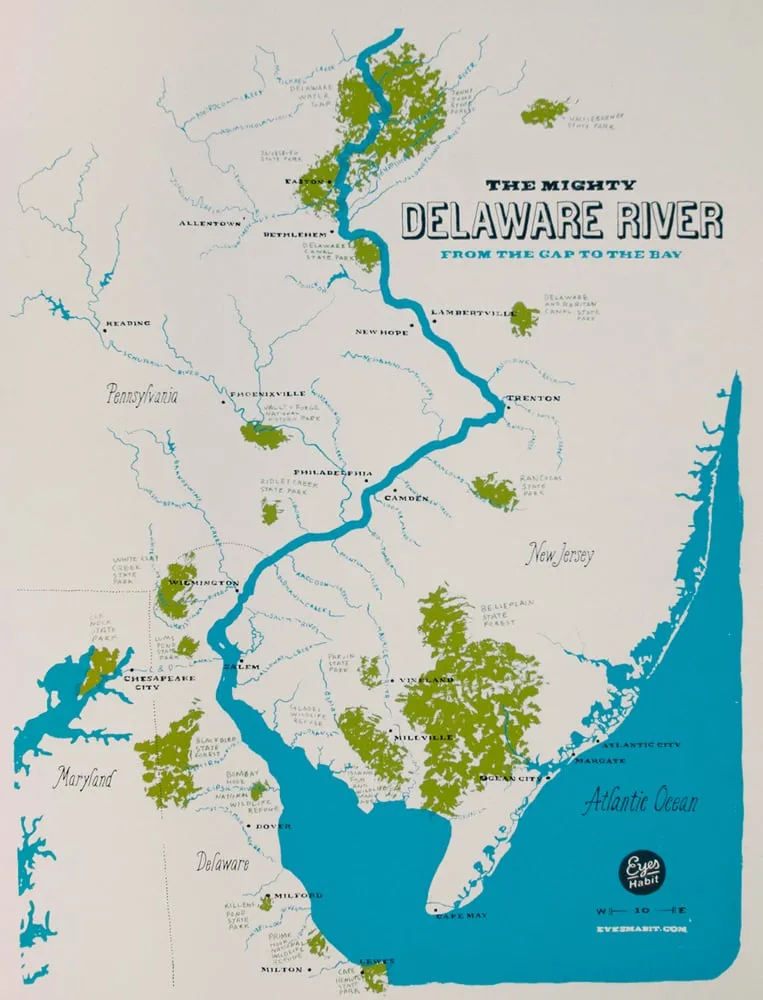 Photo: Delaware River, via assets.bigcartel.com
Delaware's boundaries were drawn to include exactly enough territory to provide Pennsylvania with river access while avoiding conflict with Maryland's land claims. The result was a state shaped like a slice of pie, with borders that follow no geographic features and reflect no cultural divisions that existed before the boundaries were drawn.
Yet modern Delawareans have developed fierce state pride based on their accidental geography. They celebrate their status as the "First State" (because Delaware was first to ratify the Constitution) and maintain cultural institutions that reinforce Delaware identity. The boundary that was drawn for Pennsylvania's convenience became the foundation for a distinct political community that treats its existence as historically inevitable.
The Psychology of Imaginary Lines
Boundaries acquire psychological weight through a process that operates independently of their original logic or accuracy. Once institutional structures—tax systems, school districts, political parties—align with arbitrary lines, those lines begin generating real cultural differences. People inside the boundaries develop shared experiences, interests, and identities that distinguish them from people outside the boundaries.
This process explains why state boundaries drawn by exhausted negotiators or confused surveyors now feel like natural divisions between distinct political communities. Residents of border regions develop different accents, voting patterns, and cultural preferences based on which side of an arbitrary line their ancestors happened to settle.
The psychological investment in boundary legitimacy creates feedback loops that make arbitrary divisions increasingly resistant to change. Communities that have organized their identity around particular boundaries interpret any suggestion that those boundaries were accidental as an attack on their fundamental sense of self.
The Missouri Compromise's Lasting Geometry
The 36°30' parallel that divided slave territory from free territory under the Missouri Compromise demonstrates how political expedients become geographic destiny. This latitude was selected not because it reflected any cultural or economic division, but because it allowed Missouri to enter the Union as a slave state while maintaining the sectional balance in Congress.
The line cut arbitrarily through Native American territories, dividing tribes and trading networks that had operated as unified systems for centuries. It ignored river valleys, mountain ranges, and climate zones that might have provided logical boundaries for different economic systems. The 36°30' parallel existed purely as a mathematical solution to a political problem.
Yet this arbitrary line shaped the economic development of the entire continental interior. Territories north of 36°30' developed free-labor economies that attracted European immigrants and encouraged industrial development. Territories south of the line remained agricultural and slave-dependent, with social structures that persisted long after slavery's abolition. The psychological and cultural differences between Kansas and Oklahoma—states that share similar geography and climate—can be traced directly to their position relative to a latitude selected for congressional convenience.
Why We Need Our Lines to Mean Something
The transformation of arbitrary boundaries into sacred geography reveals a fundamental human psychological need: the belief that important social divisions reflect deeper truths rather than historical accidents. Admitting that state boundaries were drawn through political horse-trading and surveying errors would require acknowledging that community identity itself might be arbitrary—a possibility that feels psychologically threatening.
This explains why Americans invest enormous emotional energy in defending state boundaries that were originally drawn for reasons that no longer apply. Residents of border regions develop elaborate historical narratives that explain why their particular boundary was inevitable and correct, even when documentary evidence reveals it was the product of compromise, error, or expediency.
The laboratory of American boundary-making demonstrates that humans can convince themselves that any division was always meant to be, regardless of how arbitrary its origins. Understanding this psychological process offers insights into contemporary debates over electoral districts, trade zones, and international borders—all of which involve the same human tendency to treat geographic accidents as geographic destiny.
The Map That Remade Itself
Every arbitrary boundary in American history illustrates the same psychological transformation: lines drawn for temporary convenience become permanent cultural reality through repetition and institutional reinforcement. The Mason-Dixon Line, Pennsylvania's Erie extension, Delaware's pie-slice shape, and the Missouri Compromise parallel all began as practical solutions to immediate problems. They became sacred geography because humans needed them to mean more than their origins suggested.
This process continues operating in contemporary boundary disputes, from school district redistricting to international trade agreements. The psychological patterns that convinced Americans that surveying accidents were cultural destiny remain active in every debate over where lines should be drawn and what those lines should mean. The laboratory of American geography reveals that boundaries don't reflect pre-existing differences between communities—they create the differences they claim to represent.