Severed Cities: What Disconnected Streets Reveal About the Fears We Build Into the Ground
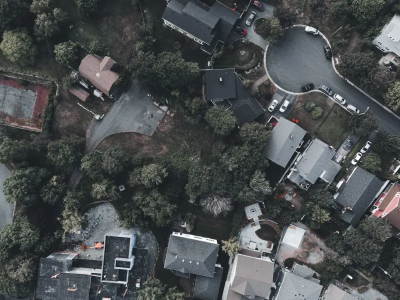
There is a particular kind of street in America that tells you everything you need to know about the neighborhood it serves without a single word of explanation. It curves pleasantly away from a main road, widens just enough to suggest comfort, and then ends. Not at a park, not at a river, not at any natural boundary that would justify the termination. It ends because someone, at some point, decided that the people living beyond it should not pass through.
The cul-de-sac is frequently discussed as a feature of suburban convenience—a quiet pocket of residential life insulated from through-traffic. What that explanation omits is the history of what the through-traffic was presumed to carry. Understanding why American streets so often refuse to connect requires understanding what connection was understood to threaten.
The Grammar of the Grid
For most of American urban history, the street grid was understood as a democratic instrument. The rectilinear plans that governed the expansion of cities from Philadelphia to Chicago operated on the premise that movement should be fluid and that commerce, community, and civic life depended on the ease with which one part of a city could reach another. The grid was not merely efficient; it was ideological. It encoded a belief that the city belonged to everyone who moved through it.
That belief was never universal, and the places where it broke down are instructive. In the late nineteenth and early twentieth centuries, as American cities expanded rapidly and absorbed waves of immigration, the pressures of demographic change began to express themselves in the language of urban planning. Certain neighborhoods began to argue—sometimes explicitly, sometimes through the quieter medium of infrastructure—that their streets should not be public corridors for the city at large.
The tools were varied. Some neighborhoods petitioned for the closure of connecting streets. Others allowed roads to simply stop at jurisdictional lines, relying on the bureaucratic inertia of multiple municipal authorities to prevent the construction of links that would have been trivially simple to build. The result, in city after city, was a patchwork of connectivity that reflected social geography with uncomfortable precision.
What Memphis Built and What It Meant
In Memphis, Tennessee, the mid-twentieth century produced one of the more candidly documented examples of deliberate street severance as a social policy. As the city's African American population expanded into previously restricted neighborhoods, traffic barriers appeared at the boundaries of white residential enclaves. These were not temporary construction obstacles. They were permanent installations, and their placement corresponded so closely to racial boundaries that their purpose required little interpretation.
Memphis was not exceptional in this regard; it was simply more transparent about it than most. Across the urban South—and in northern cities that preferred to believe themselves exempt from such logic—the strategic placement of dead ends, the refusal to extend streets across neighborhood lines, and the careful routing of highways through Black communities rather than around them all reflected the same underlying calculus. Infrastructure was a mechanism of social control, and the street plan was its most durable expression.
Human psychology has not changed in five thousand years. The impulse to build walls—literal or bureaucratic—around whatever one possesses and fears losing is among the most consistent features of the historical record. What changed in twentieth-century America was the sophistication of the instruments available to express that impulse. Zoning codes, highway placement, and street connectivity decisions gave that ancient anxiety a technical vocabulary that was far more difficult to challenge than an outright prohibition.
The Cul-de-Sac as Manifesto
The postwar suburban expansion formalized what had previously been improvised. The cul-de-sac, which had existed as an occasional planning feature for decades, became the organizing principle of entire subdivisions. Planners and developers justified it on the grounds of traffic reduction and child safety, and those justifications were not entirely false. But the timing of the cul-de-sac's ascendancy—arriving precisely as the civil rights movement began challenging the legal architecture of segregation—suggests that its appeal was not purely technical.
A neighborhood built on cul-de-sacs and loop roads, accessible only through a limited number of entry points, is a neighborhood that has made a spatial argument about who belongs there. It is a neighborhood that has decided, in the most permanent way available to it, that the city around it is not its community. The irony is that this choice, made by one generation as a defense against unwanted change, is inherited by subsequent generations who may hold entirely different values but find themselves living in a landscape that expresses the anxieties of their predecessors.
This is the peculiar cruelty of built environments: they outlast the intentions that created them. The redlining maps that organized mortgage lending in the 1930s and 1940s are gone, but the neighborhoods they described remain legible in property values, school funding, and, not incidentally, in the patterns of streets that connect some places to the city and leave others stranded at the end of a road that goes nowhere.
The Cost of the Dead End
Research on walkability and urban connectivity has documented what common sense suggests: neighborhoods with fragmented street networks generate more automobile traffic, not less. When streets do not connect, every trip becomes a detour. The isolation that was intended to protect a neighborhood from the outside world also protects that neighborhood from the economic and social benefits of being part of a city.
Beyond the practical costs, there is a psychological one. Communities that are physically organized around the premise of separation tend to reinforce that premise in their residents' understanding of the world. The street that refuses to connect is a daily lesson in the idea that the people on the other side of the boundary are not your neighbors. That lesson accumulates across years and generations, producing the resentments and mutual incomprehensions that planners and politicians then struggle to address through programs and initiatives that cannot easily reach the root of the problem.
The root is in the ground. It is in the asphalt and concrete that someone laid down decades ago to make a point about who belonged and who did not. Changing what streets say about a community requires, in many cases, literally rebuilding them—a task that is expensive, politically contentious, and slow. Several American cities have undertaken exactly this work, reconnecting streets that were severed during urban renewal or white flight, and discovering that the reconnection is resisted by the same anxieties that produced the original severance.
Reading the Record
A street map is a historical document. It records decisions made under pressure, by people who believed they were solving a problem, using the tools their era provided. Reading that document requires understanding not just the technical logic of traffic flow but the social logic of fear, belonging, and the persistent human desire to draw a line between here and there.
The streets that refused to connect did not fail to connect by accident. They were built by communities that understood, with perfect clarity, that a road is not merely a road. It is an invitation, or the withdrawal of one. And the places that withdrew the invitation most emphatically are, generations later, still living with what that withdrawal built.